Showing posts with label battle of cane hill. Show all posts

Friday, December 9, 2011

Historic Sites of the Prairie Grove Campaign

Prairie Grove Battlefield State Park
I've spent the last three weeks looking at events associated with the Battle of Prairie Grove and the Prairie Grove Campaign, which took place 149 years ago this year. I thought telling you about some of the sites of the campaign as they appear today might be a good way to wrap up the series.

I have arranged these in order beginning with Prairie Grove battlefield.


Borden Orchard at Prairie Grove Battlefield
Prairie Grove Battlefield State Park

One of America's most beautifully maintained Civil War sites, Prairie Grove Battlefield is a state and national historical treasure. Located at 506 E. Douglas Street in Prairie Grove, Arkansas, the park is only 18 minutes from downtown Fayetteville. From I-540 through Northwest Arkansas, take the Farmington exit (#62) and follow U.S. 62 West 9 miles to the battlefield.

The park preserves the scene of some of the heaviest fighting of the Battle of Prairie Grove, including the right flank of the Confederate line where Herron launched his bloody assaults, the Borden house and orchard (the house was rebuilt by the family after the war on the same foundations) and the ground across which Herron's attacks were launched. A number of historic structures are preserved at the park, which also features a museum, interpretive panels, cannon, monuments and a one-mile Battlefield Trail that loops through areas of heavy fighting. A driving tour takes visitors to other key points of the battlefield, including an overlook on the western end of the battlefield.

The park is open daily from 8 a.m. until one hour after sunset and also offers a picnic area, playground, restrooms, etc.  To learn more, please visit the park service website at: http://www.arkansasstateparks.com/prairiegrovebattlefield/.

You can read more about the battle and see photos of the battlefield at www.exploresouthernhistory.com/ArkansasPG1.


Battle of Cane Hill Historical Marker
Cane Hill Battlefield

While the Cane Hill Battlefield has not been developed as a park, efforts are currently underway to create a driving tour and install interpretive signage. The first of the panels are now up, including one at the town cemetery.

To reach Canehill (as it is spelled today) from Prairie Grove, follow U.S. 62 West for 4.8 miles then turn left (south) on AR-45 and follow it for 3.4 miles. There is a Battle of Cane Hill marker on AR-45. Be sure to see the interpretive panel at the cemetery and check out the historic Cane Hill College building on College Road one block west of AR-45. The existing building was built shortly after the Civil War, but the college was a major facility for learning when the war broke out.

Cane Hill Battlefield
The Battle of Cane Hill began just north of the college and flowed south for miles into the mountains. To view the battlefield from the highway, travel south along AR-45 for two miles to the intersection with Clyde Road. This drive takes you along the battlefield and you can view the terrain across which it was fought. The battle continued down what is now Clyde Road.

To follow the course of the fighting, follow Clyde Road for 1.4 miles to Four Corner Road. Turn left on Four Corner Road and follow it up and over Reed's Mountain (see below) for 4.4 miles to Cove Creek Road at the site of Morrow's Station (see below).  As you pass up and over the mountain, you are driving through one of the scenes of heavy fighting. Once you reach Cove Creek Road, turn right and drive until the road passes through a narrow area between the creek on your left and a rocky bluff on your right. This was the scene of the Confederate ambush that closed the fighting.

Please keep in mind that once you leaved the pavement, some of these dirt roads can be slick and difficult to travel during raining weather. Please exercise caution.

The staff at Prairie Grove Battlefield State Park can provide additional information on the Battle of Cane Hill. You can also learn more at www.exploresouthernhistory.com/ARCaneHill.


Reed's Mountain looking down to Morrow's Station
Reed's Mountain Battlefield

To reach the scene of the Reed's Mountain fight from Canehill, follow the directions given above for the Cane Hill Battlefield. The fighting took place along both sides of what is now Four Corner Road from the crest of the mountain down to the intersection with Cove Creek Road. There are no markers or other interpretation at the site. Please click here to learn more about the battle: www.exploresouthernhistory.com/ARReedsMountain.


Morrow's Station

Morrow's Station was located around the modern intersection of Four Corner Road and Cove Creek Road. It is often confused with the nearby town of Morrow, which also existed in 1862, but was actually at this site. There are no markers or other interpretation at the crossroads, but the Morrow Cemetery still exists just west of the intersection.

To reach Morrow's Station, follow the directions above for the Cane Hill Battlefield.


Cove Creek Road
Cove Creek Road

Cove Creek Road can be followed south from the Morrow's Station site into Crawford County or north from that point back to Prairie Grove. This was the main route followed by the Confederate army as it both advanced to and departed from the Battle of Prairie Grove.


Dripping Springs
Dripping Springs

To reach Dripping Springs, site of the Confederate cavalry camps, without getting lost in a myriad of small roads, I recommend that you retrace your steps from Cove Creek Road (as given above under Cane Hill Battlefield) back to the intersection of Clyde Road and AR 45. Turn left (south) on AR 45.

Follow AR 45 for 5.7 miles to the intersection with AR 59 at Dutch Mills. This community was an important landmark of the Civil War in Northwest Arkansas. Turn left on AR 59 and follow it south for 29 miles. Along the way you will pass through the stateline community of Evansville, to which Colonel Stand Watie advanced with his brigade of Confederate Cherokee during the campaign. Just south of Cedarville, look for the intersection with Uniontown Highway. A marker for the later Battle of Dripping Springs (fought later in December of 1862) can be seen just to the left of the intersection.

Turn right on Uniontown Highway and follow it roughly one mile to its intersection with Dripping Spring Road. Turn left on Dripping Spring Road and follow it for 6/10 of a mile to its intersection with Beverly Hills Drive and Old Uniontown Road. This is the site of Dripping Springs.

The Confederate cavalry camps were primarily on the hill to your left and the little spring that gives the crossroads its name is on private land to your right just beyond Old Uniontown Road. There are no markers at the site.


Confederate Section at Fairview Cemetery
Fairview Cemetery at Van Buren

To reach Fairview Cemetery at Van Buren from Dripping Springs, follow Old Uniontown Road for 4.4 miles to its intersection with AR 59.  Turn right on AR 59 and follow it for 2.7 miles until you see Fairview Cemetery on your left just after you travel down a steep hill.

In the Confederate section of Fairview Cemetery (in the northeast corner of the cemetery), you will find the graves of many of the Confederate wounded who died after the battle. Taken back to hospitals in Van Buren, they lingered in pain for weeks and months. A monument commemorates the role of these men in a series of battles including Wilson's Creek (Oak Hill), Pea Ridge, Prairie Grove, etc.

Be sure to take time to walk through other areas of the historic cemetery, where you will find the graves of many people of importance to early Arkansas history.  To learn more about Fairview Cemetery, please visit www.exploresouthernhistory.com/fairviewcemetery.html.


Main Street in Van Buren
Van Buren

From Fairview Cemetery, follow AR 59 (Fayetteville Road) south for three blocks to the train depot at Main Street.  The depot provides a great view down Main Street through the center of town.

Van Buren was the launching point for the Prairie Grove Campaign and was General Hindman's headquarters during the early stages of the campaign. It is now a charming, historic town with numerous shops, restaurants and other points of interest downtown. The historic Crawford County Courthouse a few blocks south on Main Street is of pre-Civil War construction and was a landmark of Van Buren at the time of the campaign. On its grounds can be found historical markers, monuments and the original log schoolhouse where Masonic leader and Confederate general Albert Pike once taught school. A park borders the Arkansas River at the south end of Main Street. 

Take some time and enjoy Van Buren and what this heritage minded city has to offer.  To learn more about Van Buren's history, please visit www.exploresouthernhistory.com/vanburen.


Barracks Building at Fort Smith
Fort Smith National Historic Site

Directly across the Arkansas River from Van Buren is the historic city of Fort Smith. The original
barracks and quartermaster's storehouse buildings of the fort still stand at Fort Smith National Historic Site.

The fort was used as a supply depot and command center by both Union and Confederate forces during the Civil War and its museum features an outstanding exhibit on the Civil War in and around Fort Smith.

To learn more, please visit www.exploresouthernhistory.com/fortsmith.html.


In addition to the sites I've discussed here, Fayetteville National Cemetery and Fayetteville Confederate Cemetery are definitely worth visiting. The remains of Union soldiers killed at Prairie Grove and Cane Hill are at the national cemetery, while the Confederate cemetery contains the graves of Confederate soliders killed in those fights.

Fayetteville Confederate Cemetery:  www.exploresouthernhistory.com/fayettevillecc.html

Fayetteville National Cemetery:  www.exploresouthernhistory.com/arfayettevillenc.html

And, as always, you can learn more about the Prairie Grove Campaign at www.exploresouthernhistory.com/ArkansasPG1.

Tuesday, November 29, 2011

November 29, 1862: Casualties of the Battle of Cane Hill

Fayetteville Confederate Cemetery
Some of the Southern casualties are buried here.
The morning of November 29, 1862, dawned on two exhausted military forces. The Battle of Cane Hill, fought the previous day, had been a long and difficult fight, waged up and down mountains and with no time to rest or eat.

Taking advantage of the night, the outnumbered Confederates had fallen back into the Boston Mountains and by the 30th would be back at their original camps around Dripping Springs in Crawford County. The Federals, stunned by the ferocity of the Southern ambush that ended the day's fighting, held their positions near Reed's Mountain through the night and then General Blunt moved most of his men back into the villages at Cane Hill on the 29th (149 years ago today).

Fayetteville National Cemetery
Union dead were relocated here after the war.
Both sides mourned the killing or wounding of good men, the exact numbers of which are difficult to determine.

General Blunt reported his total casualties as 4 killed and 36 wounded (4 mortally). This is probably close to accurate. I have been working on trying to assemble an accurate casualty list for both sides and while this is a work in progress, so far the numbers are bearing out Blunt's statement.

The following Federal officers and enlisted men were killed or mortally wounded at the Battle of Cane Hill:

Rabb’s Battery, 2nd Indiana Light Artillery

William E. Foster, Killed
Henry Williams , Killed

 (Note: Henry Williams was one of two men of this name in Rabb’s Battery. This one was from Indianapolis.)


 2nd Kansas Cavalry

Cyrenius M. Adams, Company K, Killed


6th Kansas Cavalry

Lewis R. Jewell, Lt. Col., Field & Staff, Mortally Wounded
Andrew Stillwagon, Company A, Mortally Wounded
Eugene Steohr, Company A, Killed
William Speeks, Company D, Mortally Wounded
George H. Richie, Sgt., Company K, Mortally Wounded


Fairview Cemetery in Van Buren
Some Confederate casualties are buried here.

Confederate casualties are much more difficult to assess. Blunt estimated total Southern losses as 75 killed and an unknown number wounded. This is wildly inaccurate.

I have just begun working on trying to identify the Confederate soldiers killed and wounded in the battle so my lists are very incomplete. The best I can do right now is give the partial numbers included in the official reports of the battle. These list Southern casualties as 5 killed, 30 wounded and 6 missing in action. These numbers include only two men from Shelby's Brigade, which suffered other men killed or wounded.

After I complete my work on the casualty lists from the battle, I will be sure to post the final numbers along with lists of the names. If you have the name of a soldier known to have been killed or wounded at Cane Hill, please leave a comment. I will verify it and include it on the list.

I will continue posting on the Prairie Grove Campaign throughout this week, so be sure to check back often. 

If you would like to read more on the Battle of Cane Hill, please visit www.exploresouthernhistory.com/ARCaneHill.

To read more about the Battle of Prairie Grove, please visit www.exploresouthernhistory.com/ArkansasPG1.

Monday, November 28, 2011

November 28, 1862: The Battle of Cane Hill, Arkansas

Historical Marker at Canehill, Arkansas
The first major fighting of the Prairie Grove Campaign took place 149 years ago today when Federal troops attacked three Confederate cavalry brigades at Cane Hill, Arkansas (now spelled Canehill).
Having advanced from his position at Camp Babcock north of Siloam Springs on November 27, 1862 (see An Attack in the Making), Union General James G. Blunt reached Cane Hill between 9 and 10 o'clock on the morning of the 28th. His force consisted of 5,000 men and 30 pieces of field artillery.

The Confederate force at Cane Hill was commanded by General John S. Marmaduke. Although Blunt reported that the Southern force numbered 8,000 men, the actual number was much smaller. The Confederates were severely outnumbered in terms of both men and artillery.

1880 Map of Cane Hill, Arkansas
The battle began near Cane Hill College at the top and
ended near Morrow's at the lower right.
The Battle of Cane Hill began when Blunt's forces attacked the Missouri brigade of Colonel "Fighting" Jo Shelby. These men were camped in the northernmost of the three villages along the Cane Hill ridge and although Shelby had been warned that the Federals were coming, he admitted that he was taken by surprise:

Having had due notice (eighteen hours previous) by the general commanding that the enemy were advancing, we endeavored to be on the alert, but I must confess (though it may reflect somewhat upon myself) that the enemy, by his skillful management, fell upon me sooner than I would have desired, considering that a portion of our division was encamped some distance in my rear and I had but little time to give them the notice required; yet I had sufficient time to place my men in their proper positions and await the coming of the hated foe. - Col. Joseph O. Shelby, Dec. 1, 1862.

Having pushed back Shelby's pickets in brisk skirmishing, Blunt moved up Captain John W. Rabb's Battery (2nd Indiana Light Artillery) along with the two light howitzers of the Second Kansas Cavalry. 

Site of Confederate Stand on Reed's Mountain
Each side later claimed that the other opened first. For the next hour or so, Shelby's two iron 6-pounders battled with the superior firepower of the Union guns. As this cannonade was underway, General Marmaduke came to the front and consulted with Shelby, who reported he had seen infantry supporting the Federal cannon. Viewing the situation in person, Marmaduke ordered Shelby to fall back to a high ridge 3/4's of a mile south where Colonel Emmett MacDonald had taken position with his cavalry brigade.

As the Confederates withdrew to their second position, the Federals followed and again formed for battle. After a sharp fight, the Southern forces again fell back to a previously identified third position.

This type of fight continued for the entire day. The outnumbered Confederates would take a good position, force the Federals to form lines of battle and bring forward their artillery and then, after a sharp encounter, fall back on yet another good position. The overall effect was that the Confederates were able to fight a slow retreat on ground of their own choosing throughout the day, instead of being routed from a single position by the much larger Union army.

The fight went back through the villages on Cane Hill and up and over Reed's Mountain into the Cove Creek valley.With darkness approaching and believing Marmaduke was now in full retreat, the Federals launched a direct cavalry attack down the Cove Creek road - and right into a trap.

Site of Ambush on Cove Creek Road
Taking advantage of a position where a steep bluff forced the road to run along a narrow strip or land or "funnel" between the rocks and the creek, the Confederates set up an ambush and the Union cavalry rode right into it:

The charge continued for about half a mile down the valley, to a point where it converged in a funnel shape, terminating in a narrow defile. At this point a large body of the enemy were in ambush in front and upon the flanks, where cavalry could not approach, with their battery also masked in front. As soon as the party we were pursuing had passed through the defile, they opened upon us a most destructive fire, which, for the moment, caused my men to recoil and give back, in spite of my own efforts and those of other officers to rally them... - Gen. James G. Blunt, Dec. 3, 1862.

A Confederate counterattack was driven back when officers - including General Blunt - were able to rally three companies of the Sixth Kansas Cavalry.

With darkness descending, the Battle of Cane Hill came to an end. The Confederates sent forward a flag of truce asking for a suspension of hostilities to remove their casualties from the field and the Federals agreed. Both sides took care of their wounded and during the night, Marmaduke and his cavalry slipped away into the Boston Mountains.

Casualties were fairly light considering the severity of the fighting and numbers of men involved, but this likely was the result of the nature of the fight with its constant stops and starts. I will look closer at the numbers in my next post.

The Battle of Cane Hill was a Union victory and as the day came to an end, Blunt and his men occupied the former Confederate positions. By winning the battle, however, he unwittingly played right into the hands of overall Confederate commander General Thomas C. Hindman, who was planning a much bigger operation.

To learn more about the Battle of Cane Hill, please visit www.exploresouthernhistory.com/ARCaneHill.

To learn more about the Battle of Prairie Grove, please visit www.exploresouthernhistory.com/ArkansasPG1.


Sunday, November 27, 2011

November 27, 1862: An Attack in the Making

College Road in Canehill, Arkansas
The news that the Confederate cavalry had crossed the Boston Mountains and occupied Cane Hill (see First Skirmish near Cane Hill), prompted the always aggressive Union General James G. Blunt into action.

Having sent out cavalry units on the 25th to skirmish with Confederate scouting units between his camp north of Siloam Springs and the Southern camps at Cane Hill, Blunt decided to attack. Even though he claimed in his reports that the Confederate cavalry numbered 8,000 men (the actual number was fewer than 3,000), the Union general organized an army of only 5,000 men to strike against them.

On November 27, 1862, 149 years ago today, the Federals moved out:

Gen. John S. Marmaduke, C.S.A.
Early on the morning of the 27th, I ordered all my transportation and commissary trains parked on Lindsey’s Prairie, and, after detailing a sufficient guard for its protection, I commenced my march, with about 5,000 men and thirty pieces of artillery, the men taking with them four days’ rations of hard bread and salt. The distance to be traveled to reach the enemy was 35 miles, of which 25 were made by 7 p.m. on the 27th, when the command bivouacked for the night. From that point I sent spies into the enemy’s camp, and learned that there pickets were strongly posted on the main road (on which I was advancing), and that it could be easily defended. - Brig. Gen. James G. Blunt, Dec. 3, 1862.

In the Confederate camps, meanwhile, General John S. Marmaduke knew that Federal troops were to the north in large force, but did not know they were on the move. His three brigades were not unified, but instead one was camped in each of the three large villages along the Cane Hill ridge. Although it was not really planned, this would allow him to fight a staggered or tiered defense the next day when Blunt attacked.

The Battle of Cane Hill would take place the next day and I will post about it tomorrow. To learn more in the meantime, please visit www.exploresouthernhistory.com/ARCaneHill.

The events were prelimaries of the coming Battle of Prairie Grove. You can read more about it anytime at www.exploresouthernhistory.com/ArkansasPG1.

Monday, December 6, 2010

Battle of Reed's Mountain, Arkansas - December 6, 1862

Original Road over Reed's Mountain
Today (December 6th) is the 148th anniversary of the Battle of Reed's Mountain, the final preliminary fight to the Battle of Prairie Grove, the anniversary of which is tomorrow.

Following the Battle of Cane Hill one week earlier, Union General James G. Blunt had kept his division at Cane Hill. The other division of the Army of the Frontier was in southern Missouri and Confederate General Thomas Hindman saw an opportunity in the miles that separated the two wings of his enemy's army. If he could push north rapidly and place his own army between the two Federal divisions, he might be able to destroy each individually before they could unite and outnumber him.

Driving north through the Boston Mountains, he struck the Cove Creek Road in northern Crawford County and crossed into Washington County on the morning of December 6, 1862. Aware that a small force of Union soldiers had been at the intersection of the Cove Creek and Cane Hill roads, to watch for Confederate movements, Hindman ordered Colonel J.C. Monroe to advance ahead of the main army and drive the Federals over Reed's Mountain where they would not be able to see his main body as it came north. Reed's Mountain is a rugged slope that separates the Cane Hill (now spelled Canehill) area from the Cove Creek Valley.

Cove Creek Valley from Reed's Mountain
Monroe moved forward rapidly and attacked the Federal pickets, driving them up and over the crest of Reed's Mountain. Union reinforcements moved up and the two forces battled back and forth for the top of the mountain. The hard-fighting Arkansas cavalrymen of Monroe's brigade, however, kept the Federals on their side of the mountain and effectively screened the northward march of Hindman's main army.

The battle would pale in comparison to the vicious fighting that would take place the next day at the Battle of Prairie Grove, but it was highly significant as it allowed Hindman to slip past Blunt and put himself into position to deliver what he hoped would be a crushing defeat to the Federals in Northwest Arkansas.

Learn more about the battle at www.exploresouthernhistory.com/ARReedsMountain.

Sunday, November 28, 2010

November 28, 1862 - The Battle of Cane Hill, Arkansas

View into Cove Creek Valley
Today is the 148th anniversary of the Battle of Cane Hill, the first significant fight of the 1862 Prairie Grove Campaign.

Having learned of the presence of three small brigades of Confederate cavalry at what is now Canehill (the name has been condensed over the years from the original Cane Hill), Union General James G. Blunt moved south on November 27, 1862, to attack them with his division of the Army of the Frontier. It was a desperate forced march made through difficult conditions. The Union army camped north of Cane Hill that night and then continued the movement forward early on the morning of the 28th.

As General Blunt later reported, he sent spies into the Confederate lines to determine the strength of their position. They returned to report that the main road leading into Cane Hill was well posted with sentries. Despite rough conditions, the Federals pushed forward on the morning of November 28, 1862, and attacked at 10 a.m. with barrages of artillery.

The severely outnumbered Confederates responded with their own guns and the fields and hills shook with the sound of cannon fire that echoed off the Boston Mountains to the south and washed over the farms, villages and towns of Washington and Benton Counties in Northwest Arkansas.

Moving around to his right to use a little known road, Blunt struck the left of the Confederate line. The Southern troops were commanded by General John S. Marmaduke and the first Confederates encountered by Blunt were led by the famed general from missouri, "Fighting Jo" Shelby.

Ambush Site on Cove Creek Road
Outnumbered and flanked, the Confederates were driven from their first line, but Blunt was taken by surprise when he surged forward to find a second line waiting. Throughout the day, Marmaduke and Shelby used multiple lines to delay and confuse the Federals. And the fighting went on all day, through the modern community of Canehill and along the road leading south to the Boston Mountains. The Confederates took up position after position, forcing the Federals to deploy and attack.

From the villages across the ridge of Rich Mountain and down into the valley of Cove Creek the fighting continued, until as darkness fell it appeared the Confederates had withdrawn. Union cavalry surged forward down the Cove Creek road, hoping to hit the retreating Confederates from behind, but instead rode directly into an ambush prepared by Marmaduke. Fire erupted from their front and flanks, dropping soldiers from their soldiers and forcing the Federals into a mad retreat.

It was not long after this that a truce was declared to collect the dead and wounded and the fighting finally came to an end. Blunt had taken his objective, but it had required a day of hard fighting against a much smaller force. Marmaduke had not given way easily.

You can learn more about the battle at www.exploresouthernhistory.com/ARCaneHill. I'll have more on the effects of the Battle of Cane Hill and its role in the coming Battle of Prairie Grove soon.

Sunday, June 13, 2010

Cane Hill College - An Educational Landmark in Northwest Arkansas

This old brick building on College Avenue in Canehill holds a unique place in the history of Arkansas. It was the last structure built to house Cane Hill College, one of the most remarkable educational institutions of the 19th century.

Northwest Arkansas was still the frontier in 1834. Fledgling settlements were taking root, one of the most important of which at the time was actually made up of a series of three communities located atop a ridge known as Cane Hill. Surrounded by good farm land in the shadow of the Boston Mountains, the settlement was well populated and a center of of activity by the Cumberland Presbyterian Church.

By the fall of 1834, the progress of the community had reached a point to allow the early settlers to think of such things as schools for their children. On October 28th of that year a group of Cumberland Presbyterians met and voted to establish Cane Hill School, which opened the following year in a two-room log building.

By the time of the Civil War, the school had progressed to become the first four-year college in Arkansas and was operating from a campus of four buildings. When most of the students of the all male school enlisted in the Confederate army in 1861, Cane Hill College closed its doors for the duration of the war.

On November 28, 1862, the Battle of Cane Hill swept across the campus as Union troops attacked Confederate forces in an important preliminary action to the Battle of Prairie Grove. Confederate artillery fired from the hill adjoining the campus and the dorm building was used as a Union military hospital after the battle. It took on more patients after the Battle of Prairie Grove on December 7, 1862.

By the end of the war much of Cane Hill had been burned to the ground and only one building from the pre-war college survived. The school would rebuild and go on to become the first coed college in Arkansas and shortly afterwards graduated the first five women to receive four-year degrees in the state.

The growth of Fayetteville and establishment of what would become the University of Arkansas, along with a destructive fire in 1885 ultimately led to a decision by the Arkansas Synod to close the doors at Cane Hill in 1891 and relocate the school to Clarksville where it continues to thrive today as the University of the Ozarks.

The building built to house the college after the 1885 fire still stands, however, and is a unique and special part of the heritage of Arkansas. To learn more, please visit www.exploresouthernhistory.com/canehillcollege.

Wednesday, March 10, 2010

Northern View of the Battle of Cane Hill, Arkansas

The following article appeared in newspapers across the North during the weeks after the Battle of Cane Hill and provides a good idea of how the Arkansas engagement was viewed by the families of Union soldiers:

Springfield, Mo., Nov. 29. - Gen. Blunt with 5,000 federals attacked and routed about 8,000 rebels under Gen. Marmaduke at Cane Hill, Arkansas, on the 20th killing 60 and driving the balance some 12 miles. Gen. Blunt telegraphs that the enemy is badly whipped, and will not probably venture North of the Boston Mountains again this winter, and as they have consumed all the subsistence in the valley of the Arkansas, they must soon retreat to Texas. (Wisconsin Weekly Patriot, December 6, 1862, p. 5).

Reports like this led Northerners to believe that General James G. Blunt had achieved a major victory at Cane Hill, a battle that actually would prove to be a significant but preliminary action to the major engagement at Prairie Grove on December 7, 1862.

In fact, the Confederate forces under General John S. Marmaduke had nowhere near 8,000 men and were actually outnumbered by Blunt's Federals. The fight actually took place on November 28, 1862, and did take place over miles of terrain, as reported by the dispatch from Springfield. Southern losses, however, were nowhere near 60 killed and the supposition by General Blunt that the campaign in Northwest Arkansas was over for the winter almost proved disastrous to him just nine days later.

To learn more about the Battle of Cane Hill, please visit www.exploresouthernhistory.com/ARCaneHill. The site includes photographs of the battlefield, Union and Confederate accounts of the battle and an in depth summary of what happened there.

Saturday, June 27, 2009

Updated Battle of Cane Hill website now online


One of the more fascinating Civil War actions in Arkansas took place on November 28, 1862, during the opening phases of the Prairie Grove Campaign.

An estimated 5,000 Union troops led by Brigadier General James G. Blunt attacked three brigades of Confederate cavalry commanded by Brigadier General John S. Marmaduke at the Battle of Cane Hill. The Southern troops had crossed the Boston Mountains from the Arkansas River in the opening move of Major General Thomas C. Hindman's march that would end at the Battle of Prairie Grove on December 7, 1862. For nine hours, Marmaduke's outnumbered Confederates fought a delaying action that raged across miles of mountains, valleys and ravines.

You can learn more about the Battle of Cane Hill, see photographs of the battlefield and read transcriptions of both Union and Confederate reports of the fighting at the newly updated www.exploresouthernhistory.com/ARCaneHill. You can also pre-order Fields of Blood: The Prairie Grove Campaign, William L. Shea's soon to be released hardcover book at the site.

Tuesday, July 8, 2008

Cane Hill Battlefield Driving Tour - Cane Hill, Arkansas


Alan Thompson of the Northwest Arkansas Civil War Heritage Trail organization tells me that the first of the interpretive panels for the new Cane Hill Battlefield Driving Tour should be ready any day now.
An important preliminary of the Battle of Prairie Grove, the Battle of Cane Hill was fought on November 28, 1862, when Union troops attacked a Confederate force camped at Cane Hill.
Actually a series of communities, Cane Hill was an important landmark in Northwest Arkansas at the time of the war and was a strategic objective for both sides because of the numerous road connections it offered.
The Northwest Arkansas Civil War Heritage Trail group has started an effort to establish a driving tour of the extensive battlefield. This is a noteworthy effort and will expand the public's opportunity to explore another major battlefield of the Civil War in Arkansas. With Pea Ridge National Military Park and Prairie Grove Battlefield State Park, the new tour will bring to three the number of major battlefields that can be explored in Northwest Arkansas.
The effort is an expensive proposition. Each of the interpretive panels for the stops on the tour cost $1,500. If you are interested in supporting a worthwhile historic preservation effort, I strongly urge you to consider this one. As I've mentioned before, I am donating proceeds from my new book, The Battle of Massard Prairie, Arkansas, to the project. If you are interested in donating, you can contact Alan Thompson at Prairie Grove Battlefield State Park. Their number is 479-846-2990 or you can email the park at prairiegrove@arkansas.com and just put Attn: Alan Thompson in the heading.
If you would like to learn more about the Battle of Cane Hill, please visit www.exploresouthernhistory.com/ARCaneHill.

Thursday, April 17, 2008

Civil War Driving Trail Coming to Cane Hill Battlefield


I received some fantastic news this week from Alan Thompson at Prairie Grove Battlefield State Park. In addition to his duties at the park, Alan also serves as the President of the Northwest Arkansas Civil War Heritage Trail.
He tells me that a project has begun to create a driving tour of the Cane Hill Battlefield in Washington County. It will be a 9 mile long auto tour with interpretive signs and a guide booklet.
Funds for the first of the interpretive panels have been made available by the Humanities Council. It will be located at the historic cemetery in Cane Hill. The design for the first panel is finished and it looks just great.
When the driving trail is complete, the panels will dot the battlefield from Cane Hill College all the way down to Cove Creek Road, pointing out key points associated with the Battle of Cane Hill.
If you aren't familiar with this important engagement that was fought just days before the Battle of Prairie Grove, please visit www.exploresouthernhistory.com/ARCaneHill.html.

Thursday, April 3, 2008

Battle of Cane Hill, Conclusion


This is the ninth and concluding post in a series on the Battle of Cane Hill, Arkansas. To read the previous posts first, please scroll down the page or check the archives section.
This photograph was taken on the Cove Creek Road at the site of the final fighting of the Battle of Cane Hill, Arkansas.
After he brought his men down from the mountain, Gen. Marmaduke turned south on the Cove Creek Road and moved a short distance to a point where the road ran through a very narrow space between the creek and the steep mountain bluffs overlooking it. The position was an ideal place for an ambush and Marmaduke was quick to take advantage of it.
Leaving a portion of his command to draw the Federals on, he formed a large body of men here and planted his artillery in a masked position. The Union cavalry fell for the trap. Blunt described the ambush in his official report:
The charge continued for about half a mile down the valley, to a point where it converged in a funnel shape, terminating in a narrow defile. At this point a large body of the enemy were in ambush in front and upon the flanks, where cavalry could not approach, with their battery also masked in front. As soon as the party we were pursuing had passed through the defile, they opened upon us a most destructive fire, which, for the moment, caused my men to recoil and give back, in spite of my own efforts and those of other officers to rally them; whereas, if they had, after receiving the enemy’s fire, passed on 200 or 300 yards, we would have secured, in a moment more, what we so much coveted – the enemy’s artillery. Emboldened by their success in defending the defile and checking our advance, they raised a wild yell and advanced toward us.
The final fighting soon ended, however, with both sides pulling back from the point of the ambush. White flags went forward and an agreement was reached to remove the dead and wounded from the field and the Battle of Cane Hill came to a close. The two sides would fight again just nine days later at the Battle of Prairie Grove.
The site of the Battle of Cane Hill today stretches across more than one dozen miles of countryside around the community of Cane Hill. A marker stands on Highway 45 and the Cane Hill College site is open to the public. Please respect private property in the area if you decide to visit.

Battle of Cane Hill, Part Eight


This is part eight of a nine part series on the Battle of Cane Hill, Arkansas. To read the previous posts first, please scroll down the page.
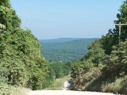
This view looks down into the Cove Creek Valley from the mountain separating the valley from the old Cane Hill settlements. The historic road followed by the troops ran through what is now a wooded area to the left of the modern road seen here.
Withdrawing ahead of the final Union attack on his lines along the crest of the mountain, Gen. Marmaduke fell back into the valley. He had successfully delayed Blunt's advance throughout the day, but with darkness approaching he decided to move his men back to a safer position.
The outnumbered Confederates pushed down the ridge to Cove Creek and turned south on the historic Cove Creek Road. Reforming his men from the fighting on the mountain, Gen. Blunt soon followed, despite the fact that the sun was beginning to set over the mountains to the west.
Our series on the Battle of Cane Hill, Arkansas, will conclude in our next post. You can always read more about the battle by visiting www.exploresouthernhistory.com/ARCaneHill.

Wednesday, April 2, 2008

Battle of Cane Hill, Part Seven


This is part seven of a series on the Battle of Cane Hill, Arkansas. To read the previous posts first, please scroll down the page.
This photograph shows the old Cove Creek Road on the Cane Hill Battlefield at the point it crests the ridge dividing the Cane Hill communities from the Cove Creek Valley.
The final Confederate line on the mountain was formed along the crest on both sides of the road and intense fighting took place here.
According to Gen. Blunt, his men pushed toward the crest and encountered fierce resistance:
The resistance of the rebels was stubborn and determined. The storm of lead and iron hail that came down the side of the mountain, both from their small-arms and artillery, was terrific; yet most of it went over our heads without doing us much damage. The regiments just named, with a wild shout rushed up the steep acclivity, contesting every inch of ground, and steadily pushed the enemy before them, until the crest was reached when the rebels again fled in disorder.
The general's description of the Confederates fleeing in disorder probably appeared that way to him, but it was actually pretty typical of the way Marmaduke fought the battle. The Southern troops were outnumbered more than 2 to 1, so the Confederate general fought the Battle of Cane Hill as a massive delaying action. He would put his men into strong positions, fight, but then as the overwhelming Union army neared the point of being able to overwhelm his lines, Marmaduke would withdraw to another point and reform to fight again.
He did this throughout the day and it proved an effective strategy as it forced the Federals to fight for every inch of ground they gained, but did not endanger the operational safety of Marmaduke's much smaller force.
Our series on Cane Hill will continue tomorrow, but until then you can read more by visiting www.exploresouthernhistory.com/ARCaneHill. The site includes more photographs, an in depth account of the battle and transcriptions of both Union and Confederate official reports.

Battle of Cane Hill, Part Six

This is part six of a series on the Battle of Cane Hill, Arkansas. To read the previous posts first, please scroll down the page.

From their position on the mountain dividing the Cane Hill settlements from the Cove Creek Valley, the Confederates could see the ground across which Blunt's Union Army was approaching. Gen. Marmaduke described the scene here in his official report:

Immediately on top of the mountain I had a part of Colonel Thompson’s command, under Major [M.W.] Smith, formed to receive the enemy, and a little to the rear of Smith, on the right, I had one company of Elliott’s scouts, commanded by Captain martin. Smith and Martin calmly awaited the coming of the enemy, and as they came charging up the hill in solid columns, they poured a deadly fire on them, which sent them staggering down the mountain. By this time I had other detachments formed but a short distance in the rear (Smith and Martin falling back and loading), who fired on them with much effect, being in easy gun-shot. Martin, having his men ready and formed, delivered once more a terrible fire, but in doing so this brigade suffered a terrible loss in the death of the gallant and heroic Martin. He fell, as he lived, fighting for his home and fireside, “with his back to the field and his feet to the foe.”

The hillside fight was among the toughest fighting of the day, but the Federals used their overwhelming superiority of numbers to push their way up the mountain. Marmaduke used a staggered defense to defend the hillside, pulling back each line to the reinforcement of the next as the Federals advanced. Finally, though, the battle reached the crest where the final Confederate line had been formed along both sides of the Cove Creek Road.
Our series will continue, but until the next post you can read more by visiting www.exploresouthernhistory.com/ARCaneHill.


Tuesday, April 1, 2008

Battle of Cane Hill, Part Five


This is part five of a continuing series on the Battle of Cane Hill, Arkansas. To read the previous posts first, please scroll down the page.
The spectacular view of Blunt's approaching army quickly convinced the Confederate commanders that they were seriously outnumbered. Deciding to withdraw into the Boston Mountains (a spur of the Ozarks) where they could hope to wage a more competent defense, they ordered their men to fall back again. The Southern troops withdrew from their second position, skirmishing as they went.
To delay the advance of the Union army, Markaduke stopped from time to time on ridges along the way and deployed his men into line of battle, forcing the Federal troops to do the same. Then, once the Union forces had deployed out and were ready for battle, he would slip away from his latest position and force them to form again for the march.
By doing this, he significantly delayed Blunt's advance, forcing the Union troops to deploy into line of battle, back into column, back into line of battle and so on for much of the day.
Finally, however, Marmaduke reached his objective, the high ridge that separates the Cane Hill communities from the Cove Creek Valley. This mountain provided a strong defensive position for the Confederates and also protected the Cove Creek Road, the only feasible avenue of retreat available to them.
Our series on the Battle of Cane Hill, Arkansas will continue. Until the next post, you can learn more by visiting www.exploresouthernhistory.com/ARCaneHill.html.

Monday, March 31, 2008

Battle of Cane Hill, Part Four


This is part four of a series on the Battle of Cane Hill, Arkansas. To read the previous posts first, please scroll down the page.
For nearly an hour the Union artillery exchanged fire with Confederate cannon posted on the heights near Cane Hill College. The Confederate advance, under "Fighting Jo" Shelby, had been surprised by the sudden appearance of the Federal troops, even though - as Shelby himself admitted - they had known for 18 hours that the enemy was coming.
Seriously outnumbered by the unfolding Union line of battle, Shelby held his position on the northern edge of town for as long as he could, then withdrew in good order to a second position along a ridge about three quarters of a mile south of his original line. The fighting withdrawal took the soldiers of both sides past the college grounds, which are now open to the public.
Reaching his new position, Shelby found the rest of Marmaduke's Confederates already in line and waiting for him. Falling into line with their reinforcements, the Confederates looked back and beheld a sight they would never forget:
Here the naked eye could see General Blunt’s columns of cavalry and infantry pouring over the hills in our front, and advancing slowly and cautiously to the attack. It was a splendid sight – flaunting banners, serried ranks, as the long lines came gleaming on….
Our series will continue. Until the next post, you can read more by visiting www.exploresouthernhistory.com and looking for the "Battle of Cane Hill" link under the Battlefields and Forts heading (on the left column of the home page).

Saturday, March 29, 2008

Battle of Cane Hill, Part Three


Learning of the appearance of Marmaduke's Confederates at Cane Hill and the skirmish involving his cavalry on the 25th, Union Brig. Gen. James G. Blunt sent dispatches to Brig. Gen. Francis J. Herron in Missouri calling for reinforcements and began a movement down from Benton County to attack the Confederate cavalry.
Due to the rough nature of the roads and time needed to get his force organized and moving, it was daybreak on the morning of November 28, 1862, before he pushed out of a ravine and advanced down the road into the northern edge of Cane Hill.
The Confederates were alert and knew he was coming. As Blunt emerged into the open ground, he found them arrayed in line of battle before him. This following account of the opening shots of the Battle of Cane Hill come from Gen. Blunt's report in the Official Records series:
Dashing on, and driving them before us, a few hundred yards brought us to where the bluff on the right terminated, and in full view of the enemy, who were posted on the right of the road, on elevated ground, with timber in their rear, their guns in battery, bearing upon the road on which I was approaching, and from which they immediately opened a brisk fire. I at once ordered Rabb’s battery into position, and also the two howitzers under Lieutenant [E.S.] Stover, when a fierce cannonading ensued, which lasted for the space of nearly an hour.
Our series on the Battle of Cane Hill, Arkansas will continue. Until the next post, you can read more by visiting www.exploresouthernhistory.com/ARCaneHill.

Wednesday, March 26, 2008

The Battle of Cane Hill, Arkansas


This is part one of a new series on the Battle of Cane Hill, Arkansas. Over the next several days, we will explore the history of this important engagement and look at some sites associated with the battle as they appear today.

The Battle of Cane Hill is often treated by historians as a preliminary episode of the Battle of Prairie Grove. While this is technically true, it was also a significant encounter in its on right that involved thousands of troops and dozens of pieces of artillery.

The battle took place when Union General James G. Blunt attacked the Cane Hill (sometimes spelled "Canehill") settlements on the morning of November 28, 1862. The community was held by around 2,000 Confederates under General John S. Marmaduke.

Blunt's men emerged from the hills and ravines north of Cane Hill at daybreak and quickly engaged Marmaduke's men in a battle that would continue for the rest of the day. Over 9,000 men took part in the fight, that raged over 15 miles of mountain country.

Watch for our next post as we begin to explore the history of this important battle. Until then, you can read more by visiting www.exploresouthernhistory.com/ARCaneHill